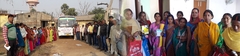
Administratively, Jehanabad district was formed on 31st July1986, Spliting away from Gaya district. Jehanabad district has one sub division and 7 Blocks namely, Ghoshi, Jehanabad, Makhdumpur, Kako, Ratnifaridpur, Hulasganj and Modanganj. Jehanabad is the head quarter of the district and the district is under Magadh division. The district comprises of 93 Panchayats and 918 villages. There are two urban agglomerations namely Jehanabad and Makhdumpur. The Proportion of urban inhabitants is 7.4 per cent according to 2001 Census. Jehanabad district is covered with Gangetic alluvial plain and the district is centrally located in the southern part of Bihar between 24º17' and 25º19' Northern Latitude and 84º and 86º East Longitude. The district is spread over 15.69 sq km constituting 1.67 Per cent of geographical area contributing 1.68 Per cent of the State Population. Proportion of Urban population is 7.4 Per cent and 92.6 Per cent population is rural.
Demographic profile
Jehanabad constitutes 1.68 Per cent of total population of the State having a population of about 1.5 million as per the 2001 Census and sex ratio (female per thousand male) of 929.
The annual growth rate of population for the decade 1991-2001 was 2.86 per cent, which was higher than the state was a whole ( i.e., 2.52 %). Such high rate of the population growth in the district indicates the vicious circle of non-development which has been found more intense in those economically backward states/regions which also have high population growth. The selected demographic Indicators has been presented in Table
It may be noted from the table that the proportion of schedules castes is much high accounting for 18.9 per cent as compared to state's average (15.7). This means that there is sizable proportion of socially and economically backward people in the district. However, the proportion of scheduled tribes is negligible in the district (0.1 percent) and the state (0.9 percent) as well. Another important aspect in regard to demographic indicator is the infant mortality rate which is high in both Jehanabad district and Bihar. The district is highly density populated in the state with a density of 982 as compared to 880 persons per sq. km. in the state. As such, there is high pressure of population on land, one of the cause for poor socio-economic condition in the rural areas. Being highly ruralised district such high density of population puts on syndrome of non-development.
|